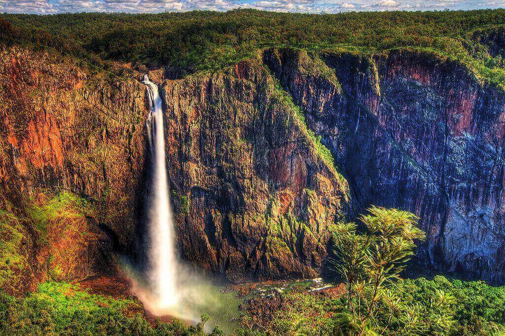
Wallaman Falls, the tallest continuously occurring single-drop waterfall in Australia, is situated within the Wet Tropics World Heritage Area. It is home to numerous endangered species and animals and some of the oldest jungles on the planet. The details on Wallaman Falls, including hiking and camping, are available here.
Wallaman Falls: The Tallest Waterfall in Australia
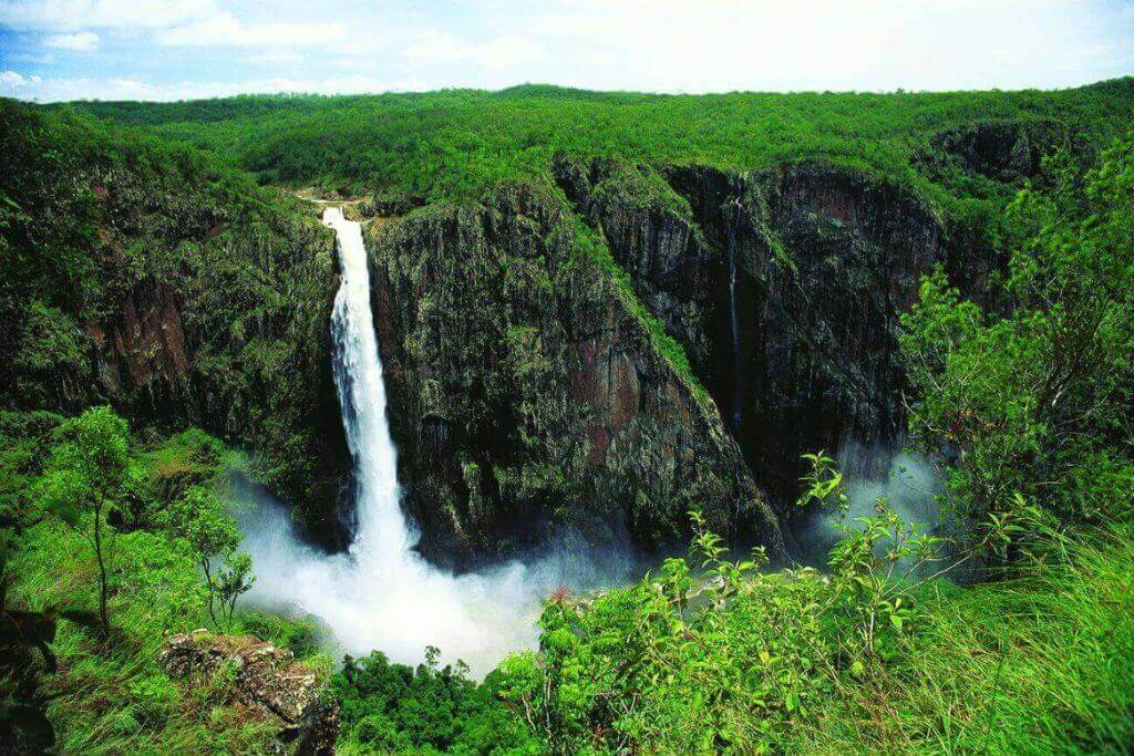
The highest waterfall in Australia isn’t Wallaman, technically. Instead, Wallaman Falls, at 268 meters (879 feet), holds the honor of being Australia’s biggest single-drop waterfall. Straight down, the water flows from the gorge’s sheer face. The water has changed into a fine mist before it reaches the bottom, which conceals the forest and gorge at the base of the falls. The mist can reflect a rainbow halo around the falls at the correct time of day, making it even more impressive.
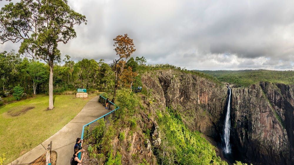
Parking is available for ten or more cars at the Wallaman Falls overlook on the east side of the gorge. A few hundred meters distant, on the other side of the gorge, are viewing platforms with safety railings that protrude out into the ravine. They also offer breathtaking views of the falls.
Less than 100 meters below the falls overlook is another lower “gorge lookout”. It offers a vantage point of the gorge as it extends to the north.
The Wallaman Falls Lookout also has a grassy area, a picnic area with tables, and a bathroom facility. It is the ideal location to enjoy a picnic in the morning, the afternoon, or the evening.
See more related posts:
- 10 Remarkable Facts About The Daintree Rainforest, Australia
- 12 Things You Can Do To Take Your Nights In Gold Coast Up To A Notch
- 7 Funniest Activities In Great Barrier Reef You Should Try
Indigenous history and culture
The Warrgamaygan Aboriginal people’s ancestral territories include Wallaman Falls. The region is home to their spiritual forebears.
Long before the term “sustainability” was coined, the Warrgamaygan people inhabited this region and took care of it. They migrated with the seasons, living a life centered around fishing, gathering, and hunting.
The Warrgamaygan people considered this land to be both their home and their source of food and other resources, as well as the thing that kept their spirituality alive. This link is still active today.
Girringun National Park: Inscribed on the World Heritage List
The magnificent Wet Tropics of Queensland, inscribed on the World Heritage List, includes Girringun National Park. A vast jungle stretches from Townsville to Cook Town and from the Great Dividing Range to the Great Barrier Reef, covering an area of around 9000 square kilometers. Parts of the Wet Tropics are 180 million years old and have been continuously inhabited by people for more than 5000 years, making them incomprehensibly old. It has been designated a World Heritage Site due to its breathtaking beauty, unfathomable history, and enormous cultural significance.
At the southern extremity of the Wet Tropics, the rough Girringun National Park covers an area of more than 1,500 square kilometers. Ancient volcano ruins, towering peaks, and deep canyons carved out over millennia dominate the landscape. It was all covered in the lush green of the rainforest.
Once known as the Lumholtz National Park, the area renamed in 2000 to honor the Girringun native groups with ties to the region. The Warangnu, Jirrbal, Warrgamay, and Girramay tribes have resided in this area for thousands of years, and Girringun is the name of the ancient creator. The Warrgamaygan Aboriginal people have ancestral lands in the park’s Wallaman portion.
There are six distinct portions of Girringun National Park: Blencoe Falls, Dalrymple Gap Track, Mount Fox, Princess Hills, Wairuna, and the Wallaman area. Outside the camping area at Wallaman Falls and the Wallaman Falls overlook, the entrance to the Wallaman portion is restricted. The park’s Wet Tropics Great Walks provide access to secluded camping and hiking.
Walks at Wallaman Falls
After taking in the expansive view of the falls from the lookout, you can use the park’s bushwalking trails to get a closer look at the falls or other areas of the park.
Djyinda Walk
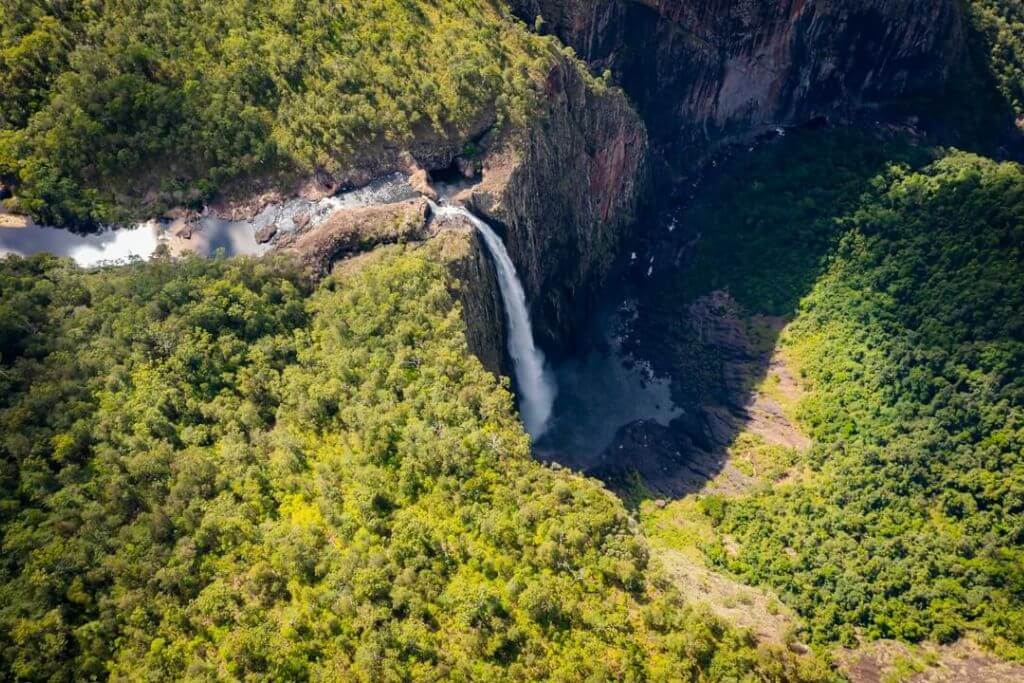
The Djyinda hike descends the eastern cliff of the gorge via a succession of switchbacks from the Wallaman Falls overlook. Over the course of the 1.5-kilometer trek, the trail is steep and descends more than 220 meters in elevation.
The dense rainforest replaces the eucalyptus forest as you go down, and you can hear the waterfall’s roar getting closer and closer. Views of the falls can be closer to the bottom through frames made by strangler figs, palm fronds, and jungle vines.
The route finally emerges into the canyon’s opening. The huge gorge is filled with the reverberating sound of tumbling water. Be careful not to slide since the waterfall’s mists coat the rocks and make them slippery. Consider the age and sheer immensity of this amazing structure as you sit on one of the gorge’s boulders.
Bangladesh Trail
The 800-meter one-way Banggurru (turtle) walk is a simple rainforest trek that departs from the Wallaman Falls Camping area if you’re searching for a shorter, less strenuous walk.
Several markers along the trail outline the tactics the various tree species used in their struggle to survive in the darkness beneath the canopy.
On the banks of Stoney Creek, the trail ends. You could be fortunate enough to see a platypus or the saw-shelled turtle, after which the creek names the trail.
Wet Tropic Great Walks
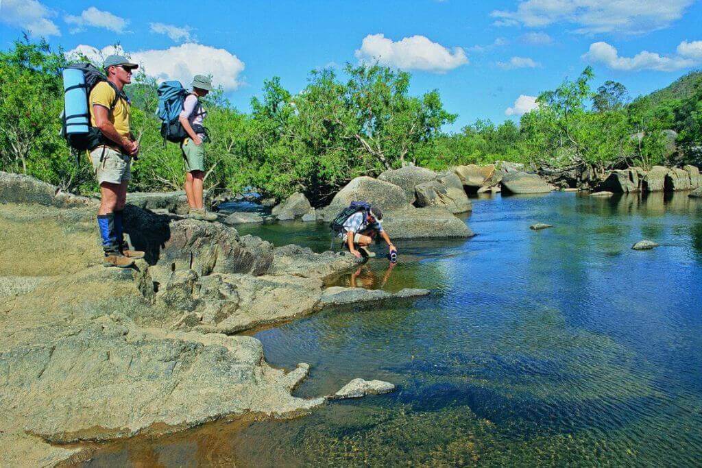
The Wet Tropic Great Walks, on the other hand, provide a challenge and a chance to immerse oneself more fully in this secluded National Park. Six alternative multi-day treks, ranging in length from 20 to 60 kilometers, are accessible across the Girrungun National Park’s 110 kilometers of paths.
Between Wallaman Falls and Blencoe Falls, there are several Great Walks. The Wallaman Falls Section of the park has three walking trails. The Queensland Government website has further details, such as maps, campground details, and trail guides.
How should I style my shoes when hiking?
Despite the majority of the day hikes being brief, the Djyinda Trail’s steep descent necessitates more than North Queenslanders’ preferred thongs (flip-flops outside of Australia). Ankle protection is aided by wearing a decent pair of high-sided walking boots.
Camping at Wallaman Falls

The Wallaman Falls Camping location, which is close to the Wallaman Falls overlook, has simple camping accommodations.
After spending a morning or afternoon wandering about and meditating over Wallaman Falls, it is the ideal spot to unwind. The falls can then be visited again in the early morning to be seen in a completely different light.
There is only tent camping permitted in the Wallaman Falls Camping Area. It has a 40-person capacity (no caravans or trailers). A day-use area is also available there without reservation.
What should I pack for Wallaman Falls Camp?
As caravan and trailer camping is not allowed at the Wallaman Falls camping area, you will require a tent. Since there isn’t treated water accessible, carry fresh water or a way to treat the water. Consider bringing firewood to use in the available fire rings as well because it becomes very cool after sundown.
Getting to Wallaman Falls
The environment transforms as you climb the Girrungu National Park, leaving the flat coastal plain and the sugar cane fields behind. Then you gradually get surrounded by forest. Be on the lookout for the region’s native cassowaries.
Girringun National Park’s Wallaman Falls is 287 kilometers south of Cairns and 162 kilometers north of Townsville. 52 kilometers west of Wallaman Falls is the town of Ingham, which serves as the highway’s exit.
The sealed route is difficult for caravans to travel on since it is steep, twisting, and narrow, even though it is easily accessible to conventional vehicles. Use the lot at the TYTO Information and Wetlands Center in Ingham to leave your caravan safely for the day.
Wallaman Falls weather
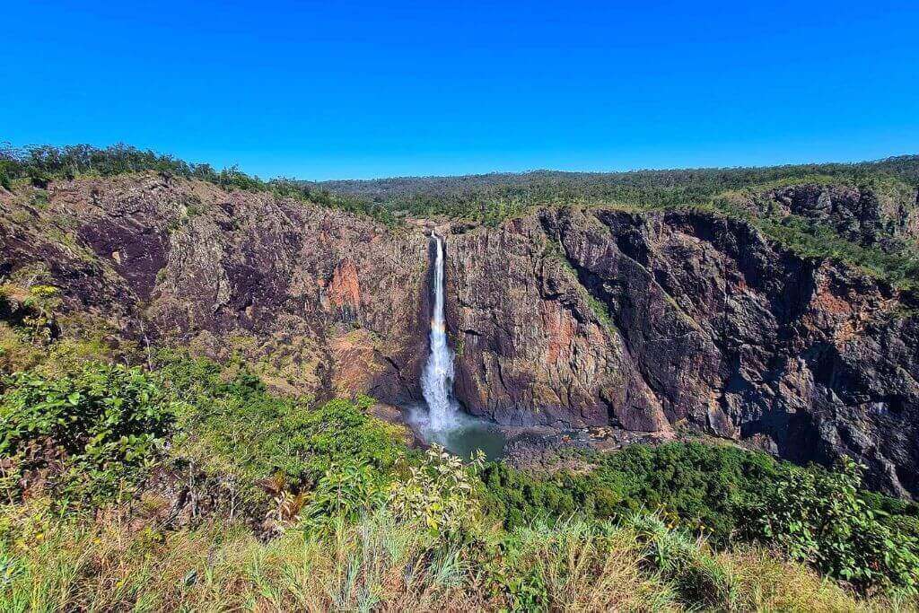
The Wallaman Falls are 554 meters above sea level and are situated in Queensland’s tropical north, where the climate is often hot all year round. As a result, temperatures here continue to be mild and are typically several degrees colder than those measured along the shore.
Due to its exposed location along the rim of a large gorge, the falls frequently overlook experience strong gusts.
The falls are typically at their most breathtaking during the wet season, which lasts from November to March. Additionally, it indicates that there is a high likelihood of rain. Additionally, constant mist of the falls is present at the base of the falls.
Walkers and campers should be equipped to handle a range of weather conditions, such as heat, wind, chilly, and rain.
When is the best time to visit Wallaman Falls?
Wallman Falls can claim the title of the highest “perennial” single-drop waterfall in Australia thanks to Stoney Creek’s year-round flow. The tropics do, however, have distinct rainy and dry seasons. The rainy season, which runs from December to March, is thought to be when the falls are most breathtaking. However, we were astounded when we arrived in late August, so don’t pass up the opportunity simply because you’re in the dry season.
Even though certain tropical regions might get extremely hot during the wet season, temperatures here continue to be a few degrees cooler than on the coast.
What attire should I bring?
Shorts and t-shirts are appropriate on warm, sunny days, but as the sun sets, you’ll want to bundle up because the temperature lowers quickly.
You should definitely bring your raincoat because there is a waterfall and it is a rainy, wet season. When winds gust over the gorge, it can also serve as an effective windbreak.
So, is it worthwhile to visit Wallamans Falls? Unanimously, yeah! Wallaman Falls is unique and ought to be on your list of the finest things to do in North Queensland and the best waterfalls to visit in Australia.
