
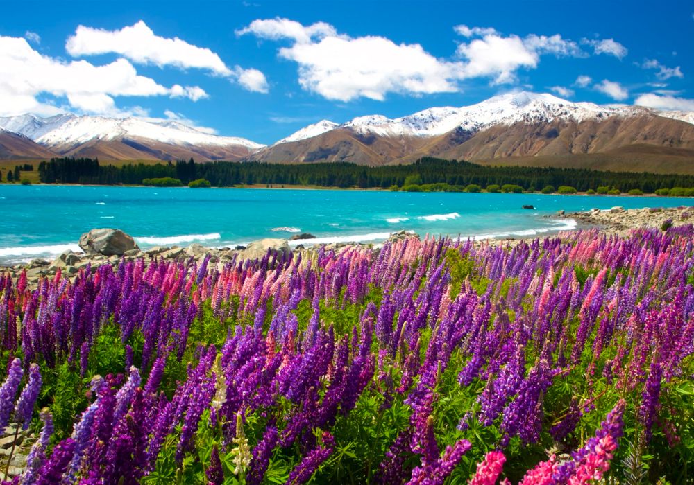
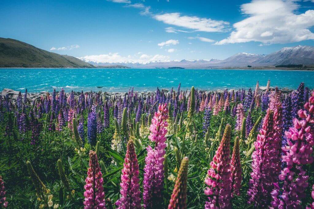
One of New Zealand’s most alluring locations is Lake Tekapo. This magnificent lake has many fascinating facts in addition to its beauty. We’ve compiled ten amazing facts about Lake Tekapo that not everyone is aware of in this article.
1. The third-largest lake in the Mackenzie Basin is Lake Tekapo
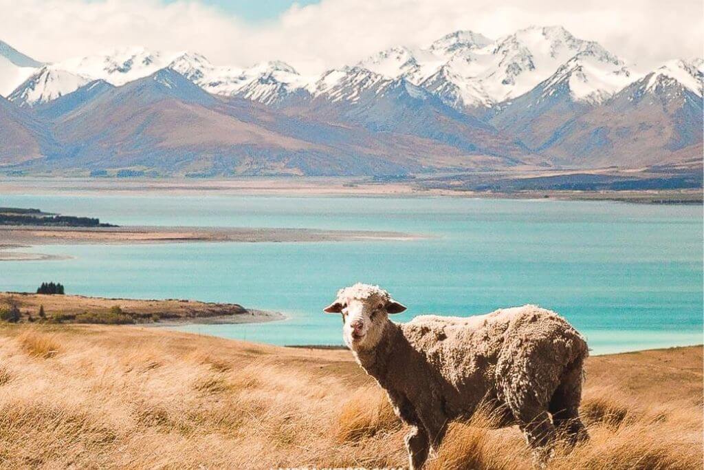
The Mackenzie and Waitaki Districts contain Mackenzie Basin, also known as Te Manahuna. James McKenzie, a Scottish shepherd, was honored with the name. The basin was well-known for raising sheep before it became a popular tourist destination.
Lake Alexandrina (640 ha) is the largest lake in the basin, followed by Lake Pukaki (178.7 km2). With a total area of 83 km2, Lake Tekapo is in third position, followed by Lake Ohau in fourth (60 km2).
The Lake Tekapo community has less than 500 homes, making the region sparsely populated. Snow-capped mountains and glacial lakes such as Lake Pukaki, Tekapo, Alexandrina, and Ohau dot the landscape.
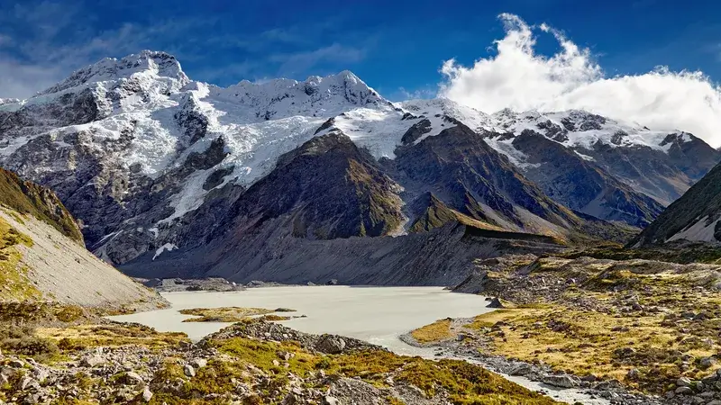
2. The Southern Mountains are the Primary Water Supply
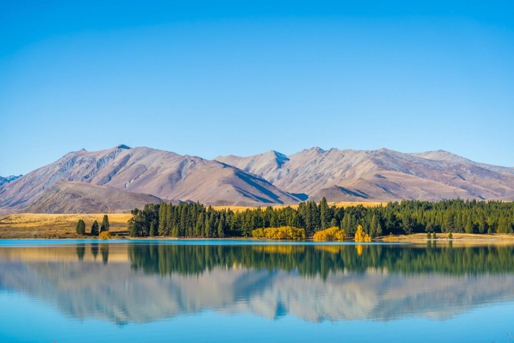
The Godley River and the Macaulay River are two of the principal rivers that drain into Lake Tekapo from the north. North of the Southern Alps is where these two rivers’ principal tributaries are located. The Southern Mountains’ melting snow is what gives the Lake its characteristic light turquoise color.
Godley River originates in Mount Cook National Park and contains a network of river channels. The Southern Alps’ Two Thumb Ranges are where the Macaulay River originates.
The Mistake River and the Cass River empty into Lake Tekapo from the west. The Hall Ranges supply water to the two rivers.
3. The Māori think that Rakaihautu dug out Lake Tekapo
The te reo Maori name for the lake, Takapo, will now also be used, the MacKenzie District Council declared. In New Zealand, the Maori make up the second-largest ethnic group.
The Maori think that Rakaihautu was responsible for creating the lakes on the South Island during his explorations following his arrival in Urua waka, Nelson. His people were separated into two factions by the Waitaha explorer. His son Rakihouia led one set of travelers to South Island’s east coast while he traveled to the center of the island.
When harvesting food (eels and weka) to store and preserve for the chilly winter season when food was limited, the chief Maori, Ngai Tahu, would travel to Lake Tekapo and Lake Alexandria.
4. Located in the middle of Lake Tekapo is Motuariki Island
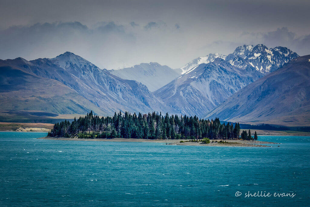
The island of Motuariki is called for Motuariki, an ancestor of the Arai-te-uru. It is believed that the waka (Maori canoe) capsized on the Otago coastline around Shag Point. When daybreak arrived, the passengers on board made the decision to explore the surrounding areas, and many of them never returned to the waka.
One of those who perished was Motuariki, who, according to mythology, was changed into an island in the center of the lake.
5. It is one of New Zealand’s sunniest locations
One of the sunniest sites in New Zealand is Lake Tekapo, which has six and a half hours of sunshine on average per day. The snow-covered peaks of Mount Cook can be seen from Lake Tekapo on a clear day.
6. The Village of Lake Tekapo is a Well-Known Tourism Location
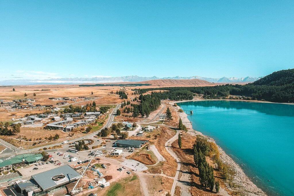
Visitors can engage in recreational pursuits like swimming, boating, and cross-country skiing at Lake Tekapo. On the lake’s shallow eastern margins, swimming is permitted. Despite the fact that boating is permitted, there are zones with speed limits.
In the winter, the village of Lake Tekapo is overrun with snowboarders and skiers. The Roundhill and Mount Dobson ski areas are the closest to the town.
7. It’s a Section of the Lake Tekapo Regional Park
On Lake Tekapo’s eastern coast is Lake Tekapo Regional Park. Since 1989, it has been managed by the Environmental Canterbury Regional Council. Conifer trees currently cover its lovely terrain, which was once a reserve for the conservation of soil.
A 24 km shared-use trail in the park is great for running, mountain biking, and strolling.
8. Lake Tekapo Is Included in a Hydropower Project
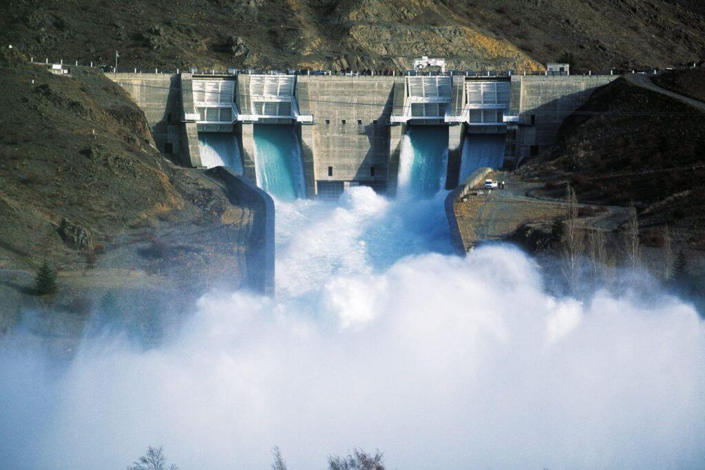
There are 8 power stations in the Waitaki Hydro System, which extends from Lake Tekapo to Lake Waitaki. The South Island’s strong need for electricity led to the creation of the program.
The 1920s saw the start of construction on the first station as the New Zealand government realized the potential of the Waitaki Valley to generate energy.
The Tekapo River once flowed southwest from the southern end of Lake Tekapo before entering the Pukaki River. The water from Lake Tekapo was diverted into Lake Pukaki by the Waitaki Hydroelectric Project using a canal. The canal now carries the majority of Lake Tekapo’s outflow.
9. The Aoraki Mackenzie International Dark Sky Reserve includes it (DSP)
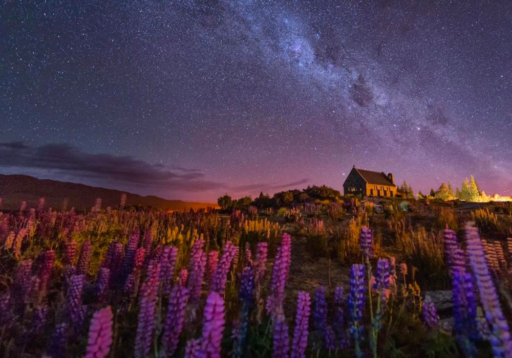
A protected region called a “black sky reserve” forbids the inappropriate or excessive use of outdoor artificial light. As a dark sky is linked to mathematics, science, societal progress, and many aspects of history, it supports astronomy and defends environmental history.
The International Dark Sky Association declared Aoraki/Mount Cook National Park and the Mackenzie Basin as Aoraki Mackenzie International Dark Sky Reserve in June 2012.
The Mackenzie Basin is home to the Mount John University Observatory of the University of Canterbury. Astronomy-related tourism will contribute more and more to the local economy as astrotourism businesses expand.
10. National Highway runs along Lake Tekapo’s southernmost portion
The loop across Central Otago and the Mackenzie Basin is created by State Highway 8. It is one of New Zealand’s eight national thoroughfares. From Fairlie, SH8 travels west and passes the southernmost portions of Lakes Tekapo and Pukaki.