
The Brisbane Ranges National Park, which was formerly a popular location for gold mining, is frequently frequented by adventurers looking to get away from the city for some trekking and camping. You’ll feel like you’re distant from civilization while still being close to the huge city. Here are all you should know about Brisbane Ranges National Park before camping there, from a detailed guide to a map.
About Brisbane Ranges National Park
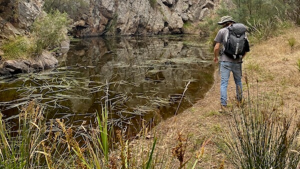
The Brisbane Ranges are located between Geelong and Ballarat, roughly an hour’s drive west of Melbourne. There are many Eucalyptus trees, grass plants, and other native Australian plants and animals in this dry area, including several Koalas, Kangaroos, Wallabies, Lizards, and Snakes. There are numerous hiking routes and two main campgrounds spread out over the national park, making it a perfect destination for a day hike or weekend camping excursion.
The Brisbane Ranges National Park’s terrain and ecology are very distinct from most other sites within a few hours of Melbourne because of the red soil and jagged granite cliffs and gorges. It’s considerably quieter and more serene than you’d anticipate for a place this gorgeous that’s so close to a big city.
See more related posts:
- Day Trips From Brisbane: 12 Best Trips That Will Release Your Stresses
- 17 Remarkable Facts About The Great Barrier Reef Not Everyone Knew
- Josephine Falls: The Best Natural Swimming Pool In Cairns
- New Year’s Eve 2022/23 In Gold Coast: All About Fireworks And Events
Camping Guide At The Brisbane Ranges National Park
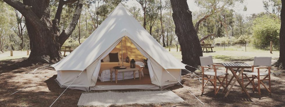
The Brisbane Ranges National Park has two campgrounds that are accessible by car. Both are in excellent locations, are kept up well, and are near numerous hiking trails that either go through them or begin there.
The Boar Gully Campground is located in the park’s northern region. There are seven distinct campsites, with sites 1-6 reserved for tents and one for camper trailers. There is a dam where you can go fishing, and there are well-kept drop toilets next to a tank and rainwater for cleaning up. However, the water is not fit for drinking, so bring plenty of your own because it can get rather hot and dry here.
Each campground is spacious, and the pitches are dispersed among bushes and plants, which increases the feeling of privacy. Boar Gully is wonderful camping with an isolated atmosphere in the dry Eucalyptus forest. You almost don’t realize you’re camping near three major cities when you’re enjoying the Australian bush’s sounds.
Friday’s Campground is about 20 to 25 minutes south of Boar Gully and immediately north of the former mining settlement of Steiglitz. Large pine trees that cast a wide shade are present. There are a total of 10 campsites, 2 of which are specifically constructed for camper trailers. The remaining eight campsites are placed together in an almost oval configuration, with a dirt road around the entire area. The area is relatively central to the Brisbane Ranges and offers facilities as well.
Due to all of the tent campsites being next to each other and cars having to drive around the entire campground, Fridays are perfect for large groups camping together or families with young children. This makes it a little safer for wandering kids or allows you to camp right next to each other for multiple parties.
Getting There From Melbourne, Geelong, Or Ballarat
The Brisbane Ranges National Park is located about 45 minutes to the southeast of Ballarat, about 30 to 40 minutes north of Geelong, and about an hour west of Melbourne.
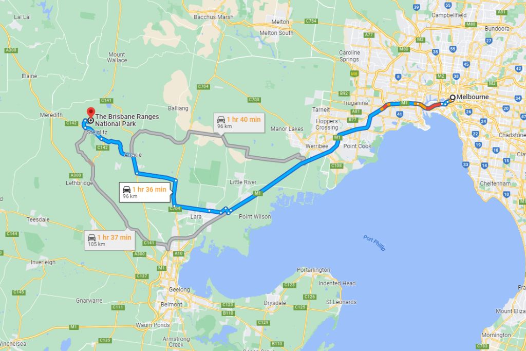
Drive west on the Princess Freeway toward Geelong and take any exits between Werribee and Little River, then continue to the north or north-west while traveling to the Brisbane Ranges from Melbourne, depending on where you’re coming from and which area of the national park you’d want to see. The Western Freeway in the direction of Ballarat is your other primary option. Take the exit before Melton and enter the Brisbane Ranges National Park from the north.
If you’re coming from Geelong, you should typically drive to Anakie and continue driving north (depending on where you want to travel). Staying on the Geelong-Ballan Road can take you into Steiglitz, and a number of other locations, or turning right at Staughton Vale Road just after the Fairy Park will take you to the picnic areas at Anakie Gorge and Stoney Creek, where there are day hiking routes.
For the best access to the two main campgrounds in the Brisbane Ranges National Park, head south on the Geelong-Ballan Road from Ballarat, then turn right onto the Midland Highway to Meredith, then turn left onto the Meredith-Steiglitz Road to the east, which will take you to Steiglitz. Alternatively, head south on the Geelong Road from Ballarat, then turn right onto the Meredith-Steiglitz Road to the east, which will take you to Steig
Given that this national park isn’t particularly large, if you head toward Anakie or Steiglitz, you’ll be able to reach your destination there quickly and simply.